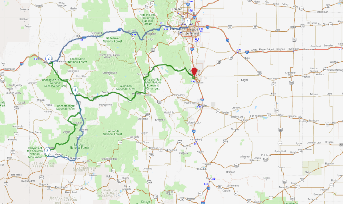
Print link

Colorado’s San Juan Skyway

Road Trip

View on Map
flickr / CC BY /daveynin
865.1 miles: 17 hours, 11 minutes
When it comes to breathtaking vistas and opportunities for invigorating outdoor recreation, Colorado is an embarrassment of riches—and the Centennial State’s southwestern quadrant is no exception. If you want jaw-dropping mountain views and loads of Old West atmosphere, drive the 232-mile San Juan Skyway, an incredibly scenic, triangular-shaped loop.
Map pin
photo credit
AAA Photo
1
Denver to Grand Junction
246.6 miles: 4 hours, 11 minutes
The views are awesome along I-70 all the way to Grand Junction, and elevation increases to a whopping 11,000 feet above sea level at the Eisenhower Memorial Tunnel, the highest point on the nation’s Interstate highway network. Take a break from driving en route and stroll around the très quaint ski resort of Vail, all gussied up like a classic Bavarian village.
photo credit
AAA Photo
2
Grand Junction to Cortez
211.8 miles: 4 hours, 24 minutes
Between Ridgway and Cortez the route winds through the Uncompahgre National Forest, a spectacularly scenic—and rugged—region where many peaks exceed 13,000 feet. Take the access road to Telluride; this small town, surrounded by the lofty San Juan Mountains, has a wild and woolly history and a view of two-pronged Bridal Veil Falls, Colorado’s highest waterfall.
photo credit
AAA Photo
3
Cortez to Montrose
159.6 miles: 3 hours, 37 minutes
Between Silverton and Ouray US 550 negotiates the dizzyingly deep Uncompahgre Gorge to the summit of Red Mountain Pass in a series of hairpin “S” curves. The views are stupendous, but the very mountainous terrain makes for challenging driving conditions; motorists must be well-versed in the navigation strategies necessary for safe maneuvering on mountain roads.
Drive trips stop
Getty Images
4
Montrose to Colorado Springs
247.1 miles: 4 hours, 58 minutes
On the way to Colorado Springs US 50 passes through Curecanti National Recreation Area, where rugged canyons and sapphire lakes provide numerous stunning photo ops. Near the junction with US 285 the highway crests 11,312-foot-high Monarch Pass in a hair-raising series of cliff-edge switchbacks, with magnificent squadrons of snow-clad peaks in the distance.