
Shutterstock.com/karenfoleyphotography
253.6 miles:
10 hours,
3 minutes
This ramble up North Carolina’s barrier islands is for lovers of lighthouses and pirate lore, seashores and shipwrecks. You (and your vehicle) will take three ferry rides as you explore this necklace of islands stretching along North Carolina’s east coast. Be aware of both tropical storms and severe winter weather that can wash away roads and scuttle ferry service.

Shutterstock.com/Jorge Moro
1
Beaufort, NC to Ocracoke, NC
60.8 miles:
3 hours,
53 minutes
Delve into Beaufort’s history as a port town. Then enjoy the quiet beauty of Cedar Island National Wildlife Refuge on your way to the Ocracoke Island toll ferry. Don’t forget to make a reservation. After about two hours, you’ll land in the heart of the charming fishing village of Ocracoke in Silver Lake Harbor, a world away from your cares.
Shutterstock.com/MarkVanDykePhotography
2
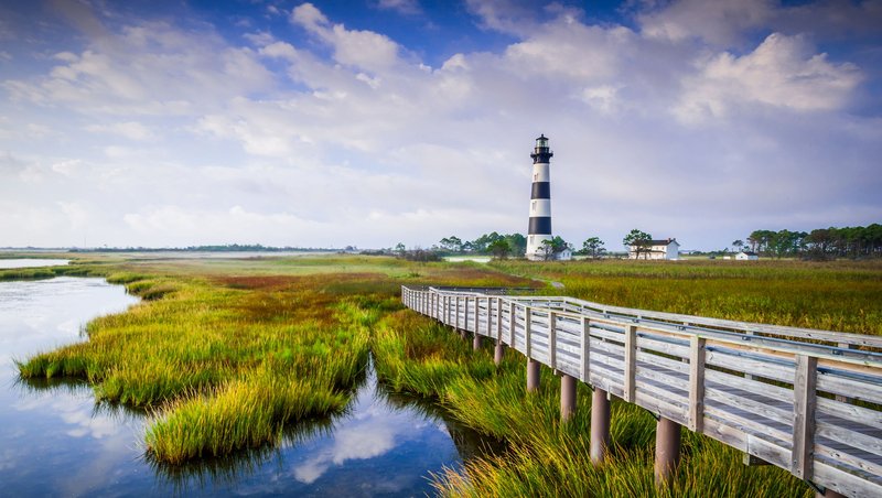
Ocracoke, NC to Nags Head, NC
91.2 miles:
2 hours,
59 minutes
The free Hatteras Ferry takes you to the southernmost coast of Cape Hatteras National Seashore, a special place in the heart of the Outer Banks where the road is so narrow in some spots that you can see the sun rise over the ocean and set over Pamlico Sound. Each of the towns along N.C. 12 has its own rhythm worth experiencing, and most cars have oval OBX stickers.

Shutterstock.com/Action Sports Photography
3
Nags Head, NC to Virginia Beach, VA
101.6 miles:
3 hours,
9 minutes
Next, it’s on to the more populated part of the island and skyscrapers of sand dunes. Brightly colored hang gliders still dot the sky at Nags Head and Kitty Hawk near the Wright Brothers National Memorial—a reminder of the earliest fliers. Take a final ferry ride across Currituck Sound en route to the Virginia coast to explore historic coastal parks and city sights.
